Ben More Mull the last Munro

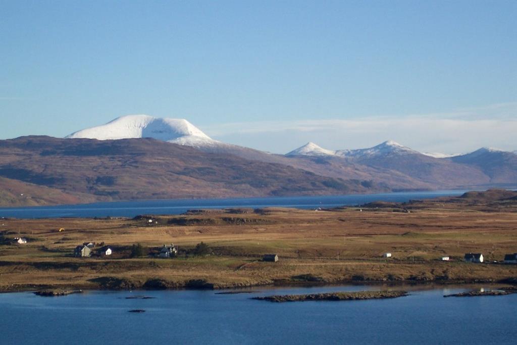
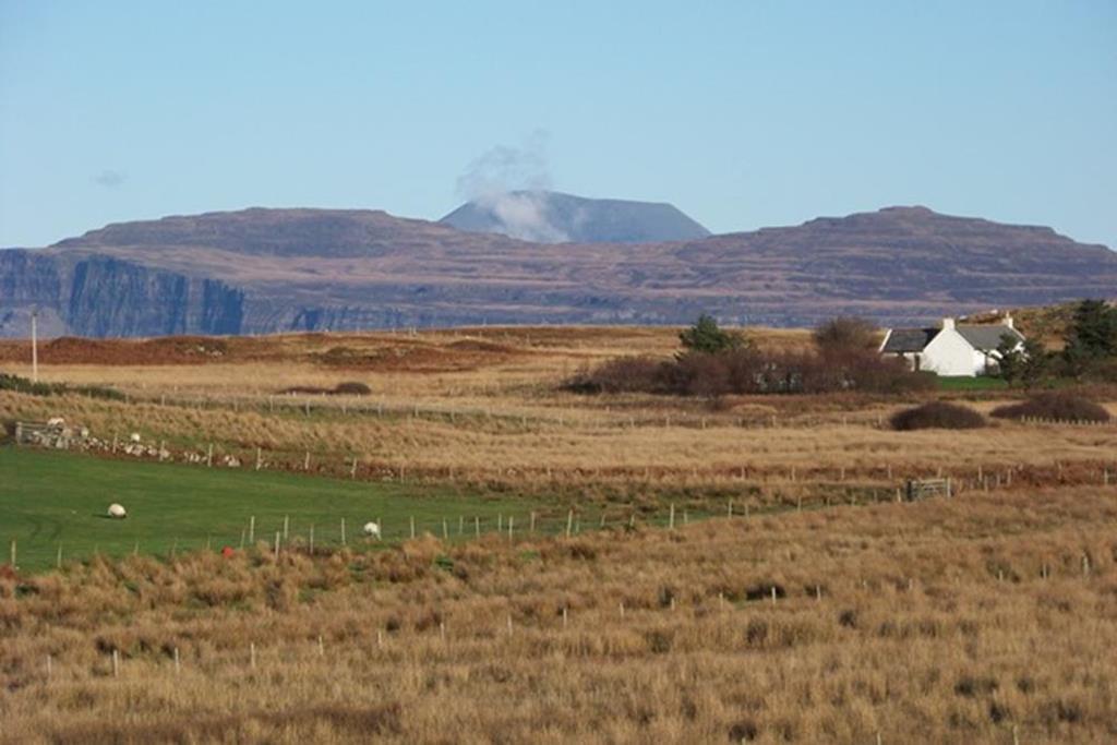
Ben More and Mull Hills from Pennyghael with Loch Scridain below
Altitude 966 metres (3,172 ft); Grid Reference: 525330
Maps: Landranger Map 48 Iona West Mull & Ulva | OS Explorer 373 West Mull -half hour drive from Seaview bed and breakfast
Check Weather Forecast
Click on photos below to enlarge
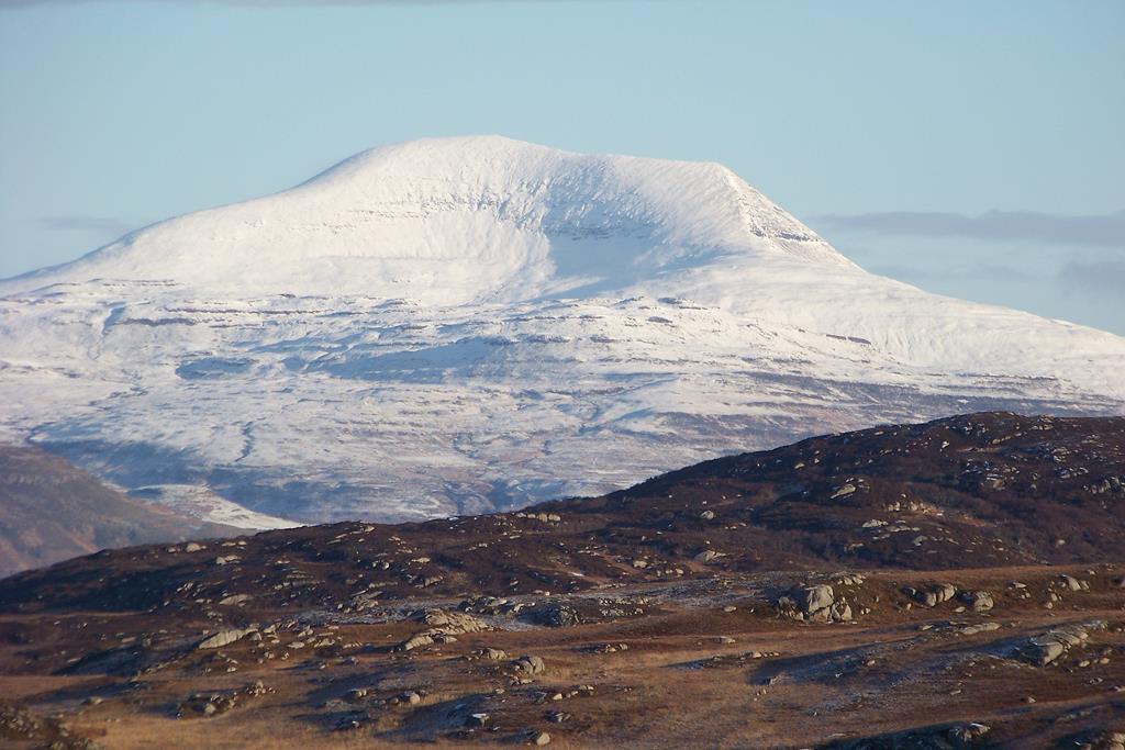
Snow Capped Ben More Suidhe Ross of Mull
Ben More is the only other Munro (mountain over 3,000 feet) on a Scottish island other than the Cuillin Peaks on the Isle of Skye. It is a fine lonely peak and a truly grand mountain of lower grassy slopes, clear clean waterfalls, craggy ridges and a fine scree top. Ben More is Gaelic for 'big hill'.
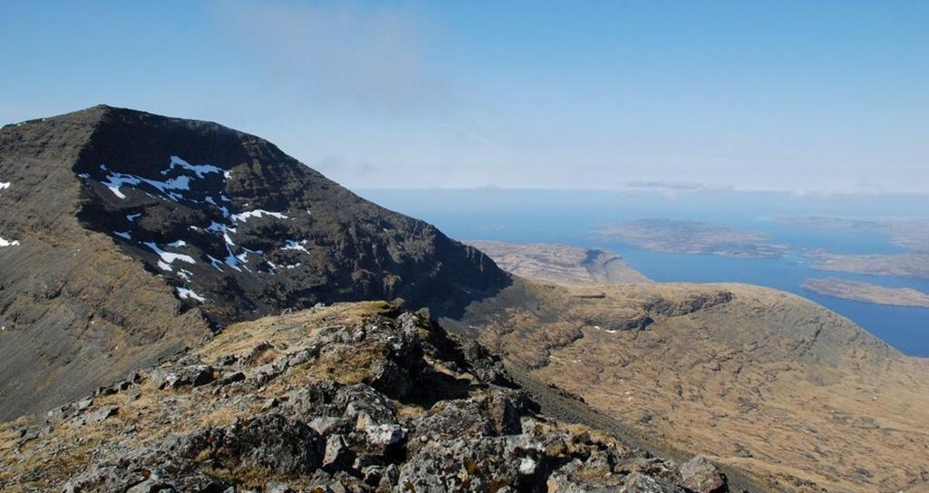
This land mass is thought to be the remains of what was once the largest volcano in Europe. On a good day the views from the top allow you to see Ireland, the Outer Hebrides and to the north east Ben Nevis and to the east Ben Cruachan.
Locally you will see the Isles of Iona, Staffa, Inch Kenneth, Treshnish Isles, Coll, Tiree, Rhum, Eigg, Islay and the Paps of Jura. To the north the jagged, saw-edged, black Cuillins perhaps let you believe that Ben More is a more rounded, gentle, easier mountain, but don't be fooled. As the highest peak on Mull and over 3,000 feet it attracts it's own weather and this can be as good or bad as any on the west coast.
Snow covered Ben More from Tor Fhada Ross Of Mull
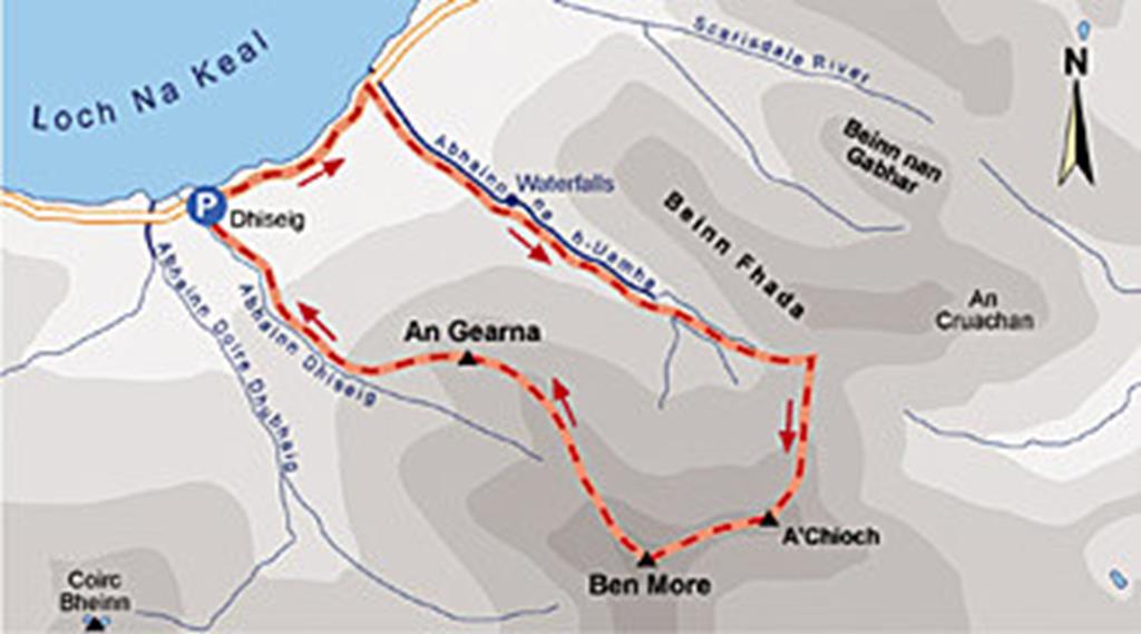
On the easier route from Dhiseig (Sacrificial Stone) you are thankful near the top that there is a wide path that you shouldn't miss especially when the compass is known to be inaccurate on this volcanic rock which has magnetic qualities - so be careful!
Also keep in mind that when you climb the 966 metres of Ben More you almost climb every metre from sea level and boy! you feel every metre of it when you finally descend back down to your car at Dhiseig. Seaview bed & breakfast accommodation in Fionnphort on the Ross of Mull is an ideal base for visiting Mull, Iona, Staffa and for a spot of 'Munro-bagging'! See our BOOK DIRECT 3 DAY BREAKS
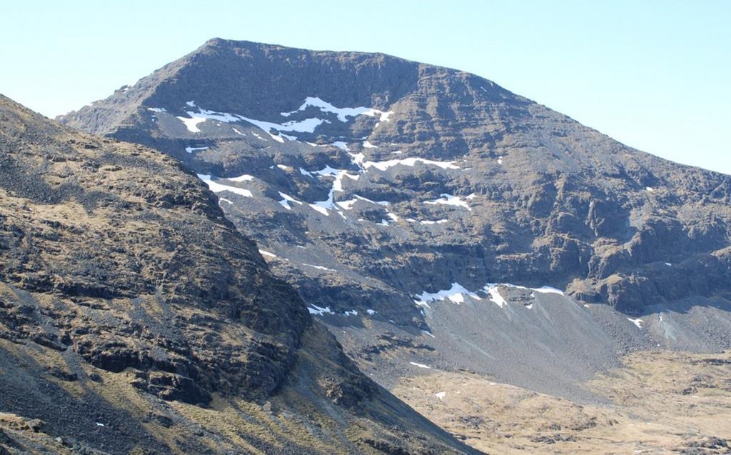
North Face Ben More Mull
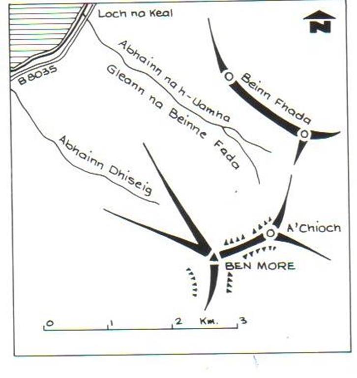
Seaview is approximately 20 miles from the base of Ben More and 28 miles from the starting point of the described walks at Dhiseig on the B8035. On leaving Fionnphort drive east down Loch Scridain on the A849 to Pennyghael and Kinloch. Across Loch Scridain on your left Ben More, A'Chioch and Beinn Fhada will come into view as you drive east. On leaving Pennyghael(Penny Land of the Gael), turn left onto the B8035 and drive west and then north leaving Loch Scridain and on to the south shore of Loch na Keal and the Gribun cliffs. After the cliffs (not recommended for climbing, broken rock!), as the north side of Ben More comes into view, park on the left by Abhainn Dhiseig (River of the Sacrificial Stone) NM 49473598.
THE ASCENT
A Chioch ridge to Ben More
For a moderate walk with a short scramble, walk north east along the road to the bridge at NM50703676. This walk will take 4½ to 5 hours and is for the more experienced walker and is about 12 km long. From the bridge at Abhainn na h-Uamha (Stream of the Cave), follow the south bank of this burn with its attractive pools and waterfalls up the grassy Gleann na Beinne Fada(Glen of the Long Mountain) and ascend to bealach NM53763442 between Beinne Fada andA'Chioch (The Breast). Turn south, south west to climb A'choich NM 5348331, then follow the impressive scenic narrow ridge (west, south west) onto the steep east ridge of Ben More and scramble to the summit NM 5253304.
THE SUMMIT
Classic route map for the fit experienced climber
The summit is a meeting point of 3 craggy ridges (click on sketch diagram to enlarge). The one just climbed to A'Chioch stretching northeast, a south ridge to Maol nan
From A Chioch along ridge to Ben More Summit
Damph (Rounded Hill of the Stag) and a north west ridge which divides in two between a corrie one northwest and one west northwest.
THE TOURIST ROUTE
 The easiest ascent and descent is on the west northwest branch of the northwest ridge and no scrambling is needed - a.k.a. The Tourist Route. From Dhiseig, keep on the north side of the shadow valley of Abhainn Dhiseig, then onto the west northwest ridge and return via the same route. This is the safest route for the less experienced walker
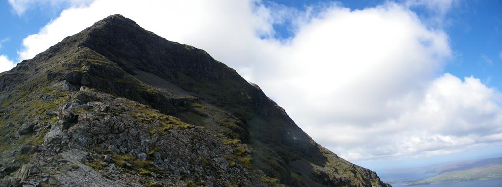
ridge walk from a chroich to Ben More summit
WILD LIFE WATCH
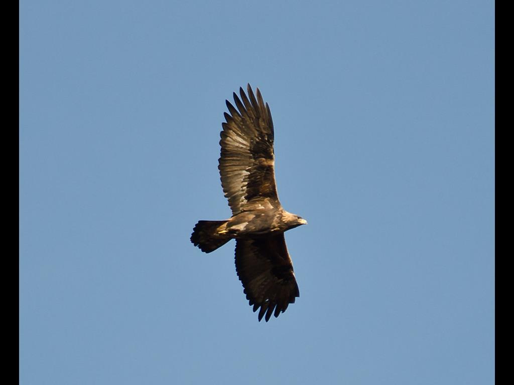
Golden eagle Ben More
Sea eagles, eagles, otters, ptarmigan (rare sightings), mountain hares, and a variety of other raptors, red deer and many watery eyed Black Face Sheep.
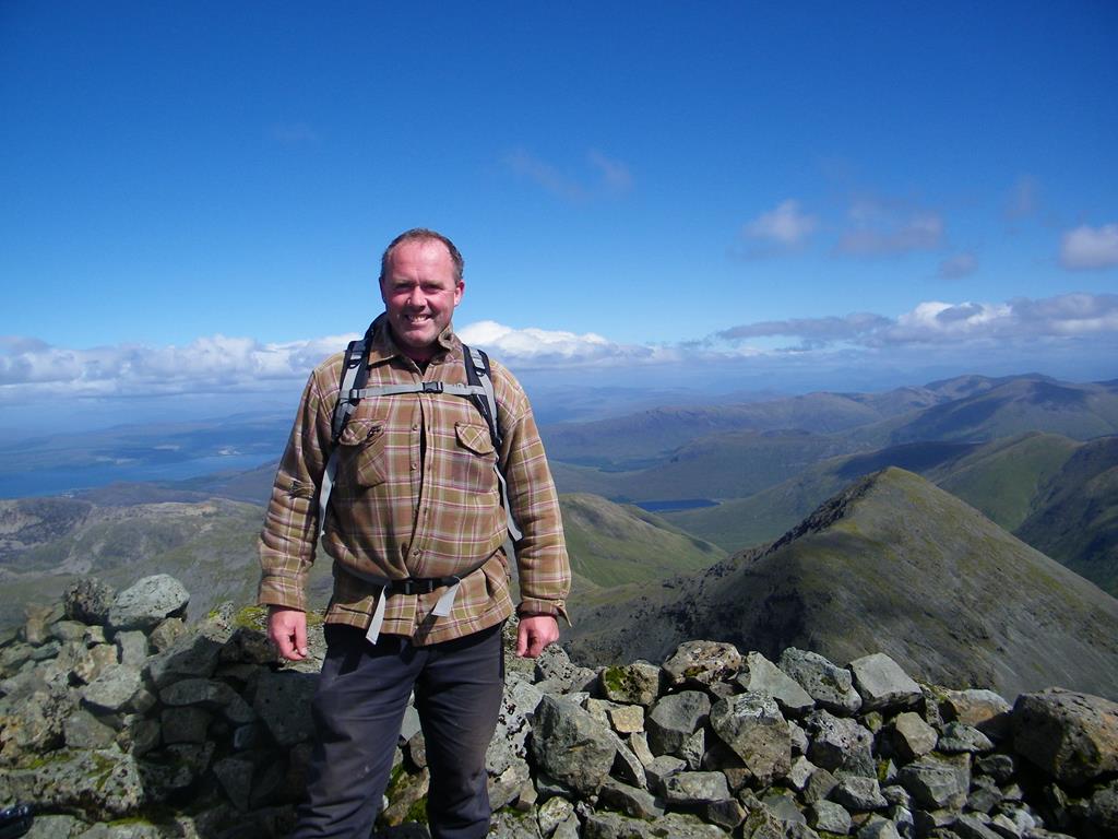
John on Ben More summit after completing ridge walk
IMPORTANT SAFETY ADVICE
Please minimise the risk to your safety by following the simple advice and guidelines below.
Ben More from Seaview
1) Be properly equipped with waterproofs and warm clothing
2) Wear appropriate strong footwear and spare clothing
3) Carry a torch, whistle, compass and map and know how to use them
4) Take ample food and drink including a flask of hot drink
Ben More from Ulva Ferry
5) Check the weather forecast
6) Be aware of the deer shooting season
7) Let someone know where you are going, your route and expected time of return
8) Turn back if you encounter problems or poor weather
Last updated 30/03/2021
© 2000 - 2021