Tireragan, a Highland Clearance township, and nature reserve and Traigh Ghael the most remote and picturesque beach on The Isle of Mull.
Traigh Ghael Beach Tireragan Ross of Mull, the remotest and most scenic beach on Mull
Click images below to enlarge
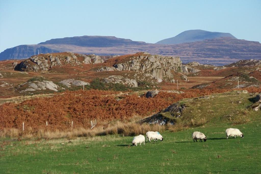
Fidden sheep and Ben More on the way to Traigh Ghael
Location: Five minutes drive from Seaview, Tireragan is a conservation estate between Knockvologan and Ardalanish on the south west tip of the Ross of Mull on the Isle of Mull. The Start point of the estate walk is located at the gate between sheds at Knockvologan OS NM314203
Walk Length: 1st option. from Seaview B and B Fionnphort to Traigh Ghael beach at leisurely pace, including some time at ruins and beach approximately 5 to 6 hours. Alternatively 2nd option take your car from Seaview to small hard grass car park, on the left opposite new house, before the Tireragan and Knockvologan gates, 5 minutes. Then Tireragan gate to Tireragan village approximately 2 hours return, to Traigh Ghael Beach up to 4 hours return 9km. If you like exploring off the main path to the oak tree or ruins it could take longer!
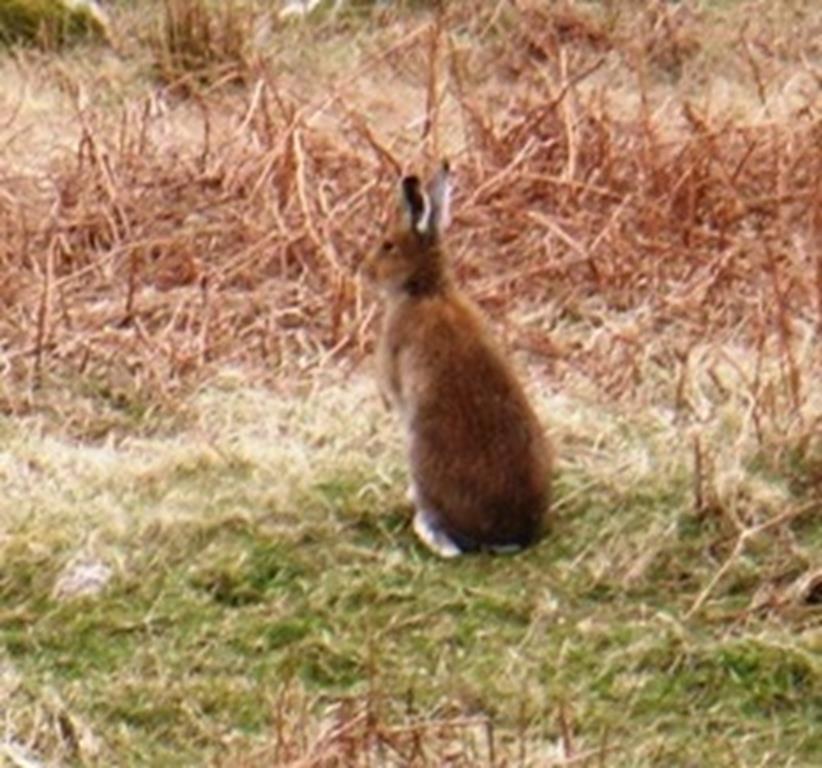
Winter or Irish Hare Fidden
Walk Difficulty: A rugged long walk with a lot of muddy, boggy sections particularly after rain. In the height of summer the undergrowth can be fairly high on each side of the path. Alternative routes are marked by arrows carved in granite stones. Recommend good walking boots and gaiters or good quality walking wellingtons. Midge repellent and sun screen in summer, water and a snack
Fidden machair Iris Bed and beach from road
Map for Area: OS 1:25000 373 Iona, Staffa and Ross of Mull. Seaview has an OS map for guests to use. John is happy to help you plan your walk, and there is back up information on the natural history and history of the area. Seaview can also provide pack up lunch if alerted the previous evening.
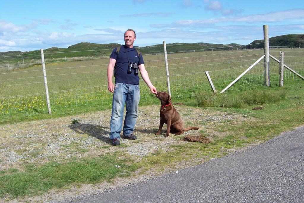
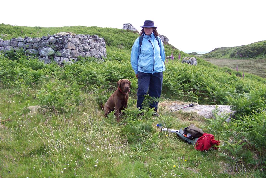
This walk provides the walker with a challenging days walking and adventure taking in the beauty of the diverse natural surroundings and long history of human settlement in this conservation area, ancient woodlands, wild bog and moor, and finally arriving at undoubtedly the finest beach on Mull, well worth the effort! John and Jane have walked this area many times over the years and the beach is without doubt their favourite. Nature treats that can be seen include red deer, otter, golden eagle, hen harrier, short eared owl, meadow pipit, seals, mountain hare, rook, emperor moth, common blue butterfly, adder and slow worm: Wildflowers include, Primrose, Flag Iris, marsh marigold, harebell, butter wort, heath spotted orchid, northern marsh orchid, may weed, biting stonecrop, and grass of panassas: trees include: birch, hazel, oak, aspen, willow and rowan. click here wild flower gallery
Fionnphort to Tireragan Start point via Fidden Lands on foot!
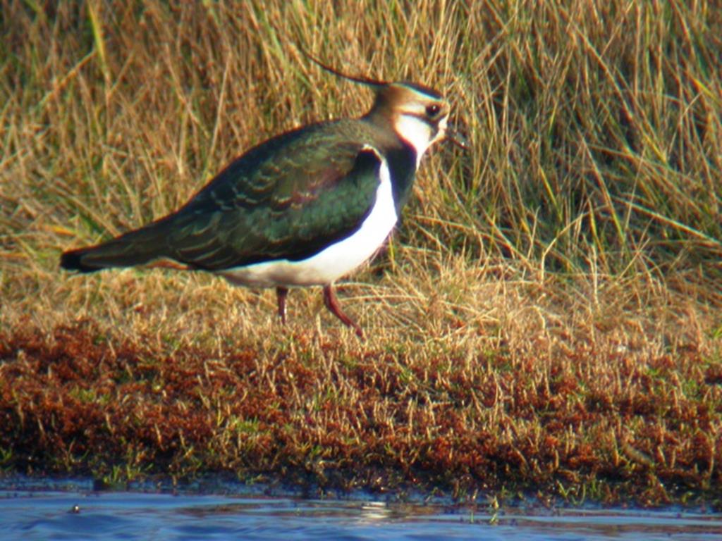
Lapwing Fidden
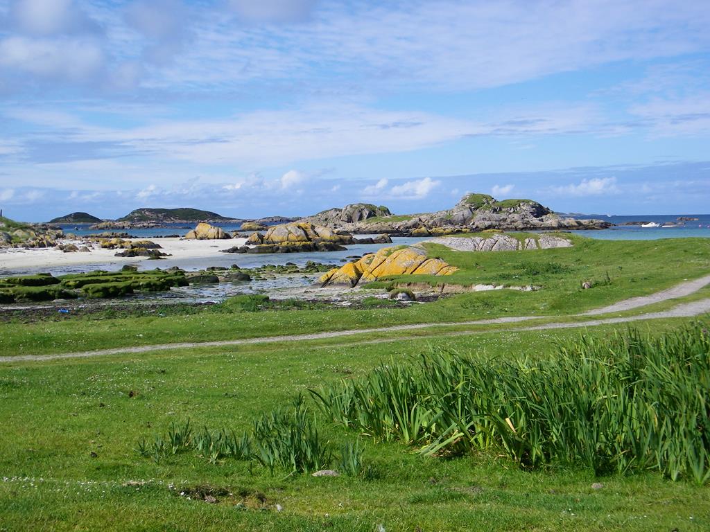
Starting your walk from Seaview B and B, walk in an easterly direction past the Keel Row pub and turn right (south) on to the Knockvologan road. Walk up the gentle hill on the metal road past the houses out of Fionnphort and into Fidden (low lying) lands. On your right (west) there are good views to Iona and its sacred Abbey. The landscape on either side of you as you walk down the hill to Fidden Farm (1 mile) is a combination of peat bog and granite outcrops with odd areas of bracken covered grass. As well as Fidden black face sheep look out for buzzard, snipe, skylark, rabbit, red deer, kestrel and the occasional woodcock. At the bottom of the hill as you near Fidden Farm the land becomes low lying and a more diverse landscape. On your left (east) there is a mixture of machair, peat bog moor, marsh, granite outcrops and fenced fields as you near the farm. On your right there is a combination of salt marsh and machair, granite outcrops, and sandy coves of the Iona Sound.
Mary Cameron Black House
This diverse landscape encourages a wide variety of birds in summer and winter and some passing migrants especially waders.. A bird watchers and naturalists hotspot. Typical summer birds include, Corncrake, lapwing, skylark, red shank, green shank, shelduck, ringed plover and twite. In passage hen harrier, merlin, peregrine, sanderling, stints, sandpiper, godwit, golden plover and wimbril. In winter grey lag, white fronted and barnacle geese. golden eye, merganser , teal, widgeon and Eider. Keep a keen eye for an Otter!
The star attraction at Fidden, is The Fidden "Irish or Winter mountain Hares" introduced years ago by one of the previous Dukes of Argyll. Larger than our Scottish hare and of a reddish brown colour with black ear tips in summer and despite Fidden being at sea level they have bred successfully and still after all these years there coat turns almost all white in winter even although snow is rare in the area.
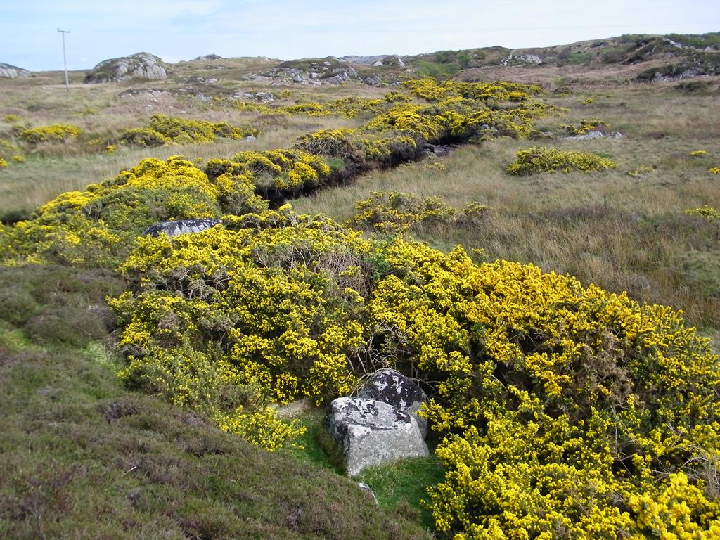
Gorse Burnside on road to Tireragan
They live on the granite outcrops in the peat bog and dine on the machair ( short wiry grass with a sand base found in the coastal areas of the hebrides) and seaweed at the seashore. Around the machair and beach at Fidden Farm there are beds of the yellow flag Iris in the damper areas. The Iris flowers usually in June and the elusive corncrake nests in the thick cover provided by the plant. Often you will hear the "craic craic " call a few feet from you but try seeing the wee blighter hiding in the undergrowth! It is easier to see the corncrake early season late April early May when there is less undergrowth.
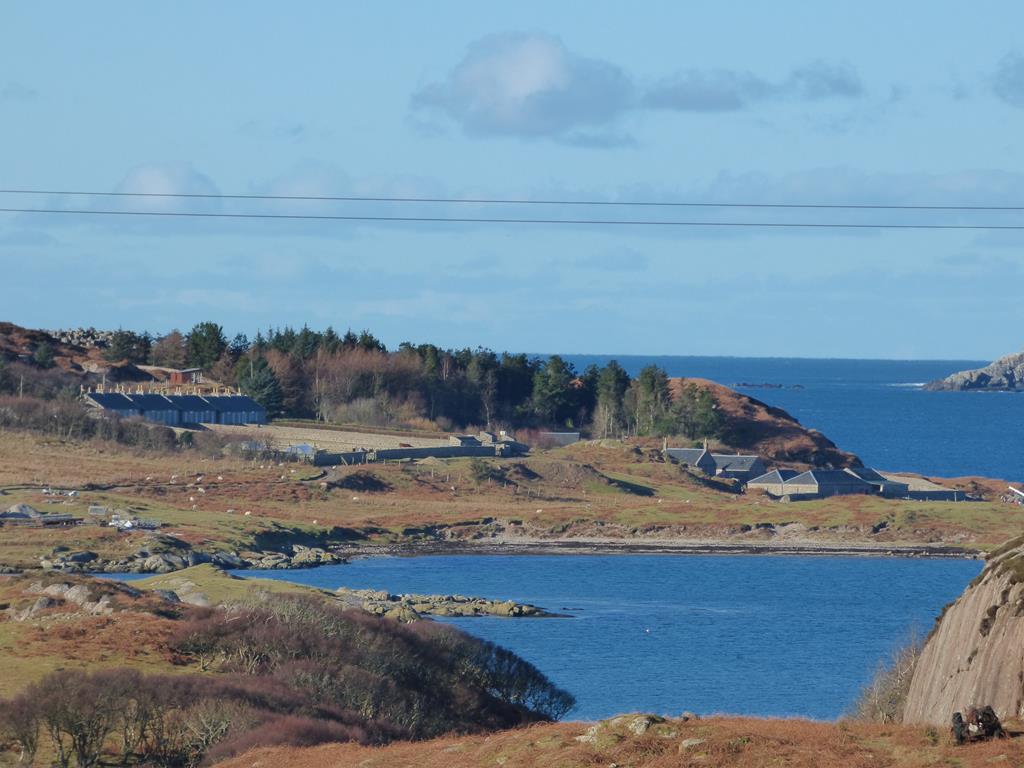
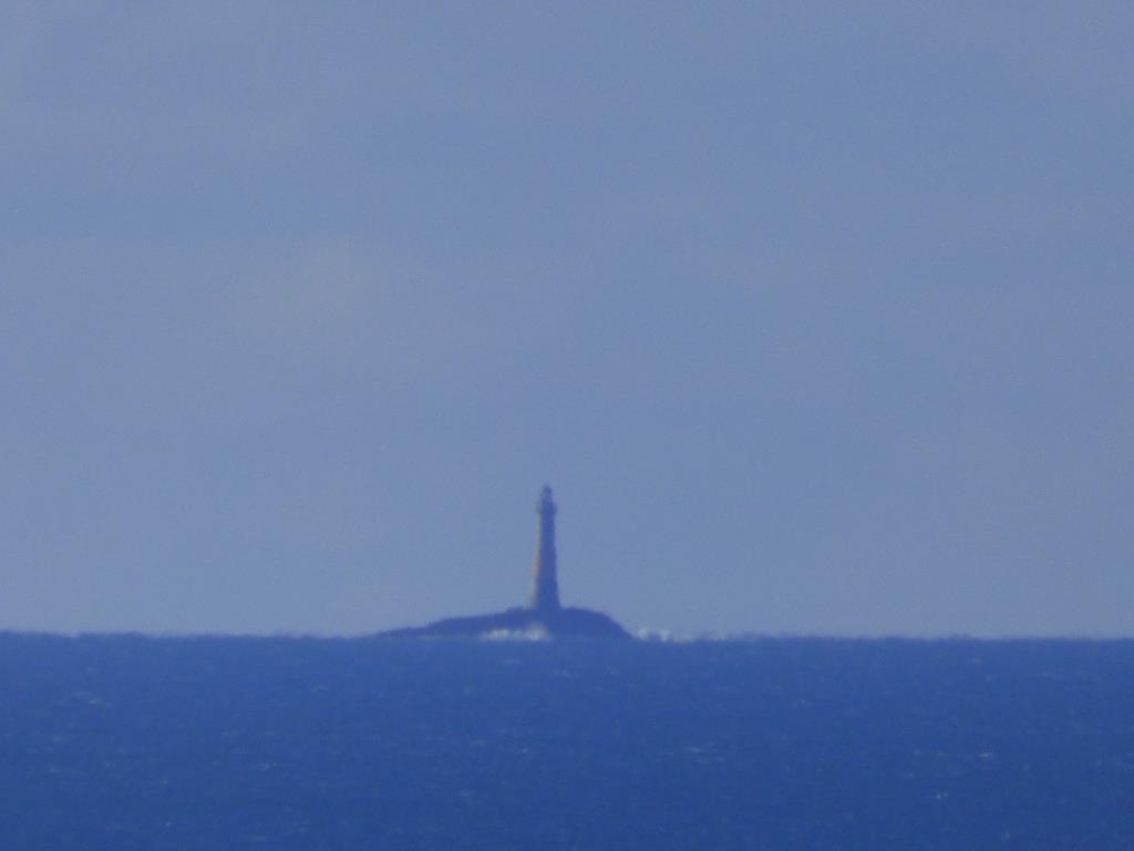
Isle of Erraid and ex lighthouse station from Tireragan Car Park
At Fidden Sheep Farm and Campsite you can access the pleasant Fidden beach with views of the Iona Sound on your right however to Knockvologan the road turns left through the farm and heads inland towards a big bungalow on the moor. On this section to the left you will notice evidence of peat cuttings, the peat once the main source of fuel for Mullichs or Mull folk. It is said you got three "heats " from peat, the effort cutting it, transporting and storing it and sitting in front of the fire! There are very few folk willing to cut peats now, there is nothing like the smell fom a peat fire!. On your right Fidden Fields and sheep and in the distance to the south, the Erraid Sound, Island of Erraid, and Northern Lighthouse Board lighthouse station and white observatory for Dubh Artach and Skerryvore lighthouses. This tidal island is the subject of another of Seaview's walks, For Erraid click here and read more
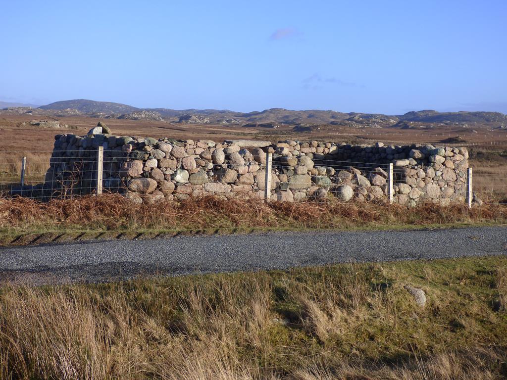
John and Meggy Car Park for Tireregan
Just past the bungalow as the road turns right on your left there is a gate (start point Pottie Trail) and a ruined black house known as Mary Cameron's Cottage. Mary passed away
Ben More from Knockvologan Car Park
in the 1960s and this would have been one of the last thatched "black houses" burning peat on the Ross of Mull. "Black house" refers to the smokiness inside the cottage where the open fires fumes and smoke went up through the room out of a hole in the roof. Folks living in the houses were almost black with the ingrained smoke on their skin. The smell of constant peat might not have been so attractive for the residents of the old black house!
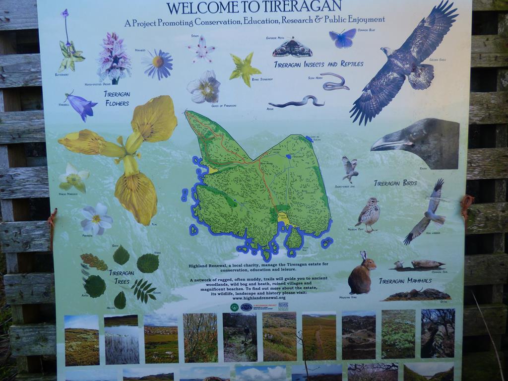
Information Board at gate at start of Trail
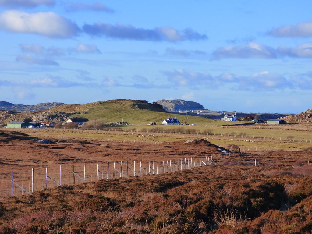
The road twists and dips to the south past Burnside which in spring and summer is awash with bright yellow gorse. Past Burnside on the estuary to the right in summer the colour then turns from yellow to pink for a short period due to a large carpet of sea pinks or thrift on the salt machair. Leaving the coastal estuary the road rises to Knockvologan's green fields then a cottage and 3 sheds on your left. At this point there is a gate in front of you across the metal road and a sign "Knockvologan Farm" This is the starting point for the Erraid Walk click here read more If you look over your shoulder to the left you will see a gate between the first and second shed and an information board for Tireragan Nature Trail, this is the next stage of your trek to Traigh Ghael beach!
If you travel by car to this point at the gates and sheds, turn your car round and park 100 metres back along the road on the right opposite a new white house on a hard standing grass car park at the field deer fence. There is a little wooden sign "car park." Please do not park at the gates or shed as the farmer needs access at all times.
Tireragan and Traigh Ghael Trail
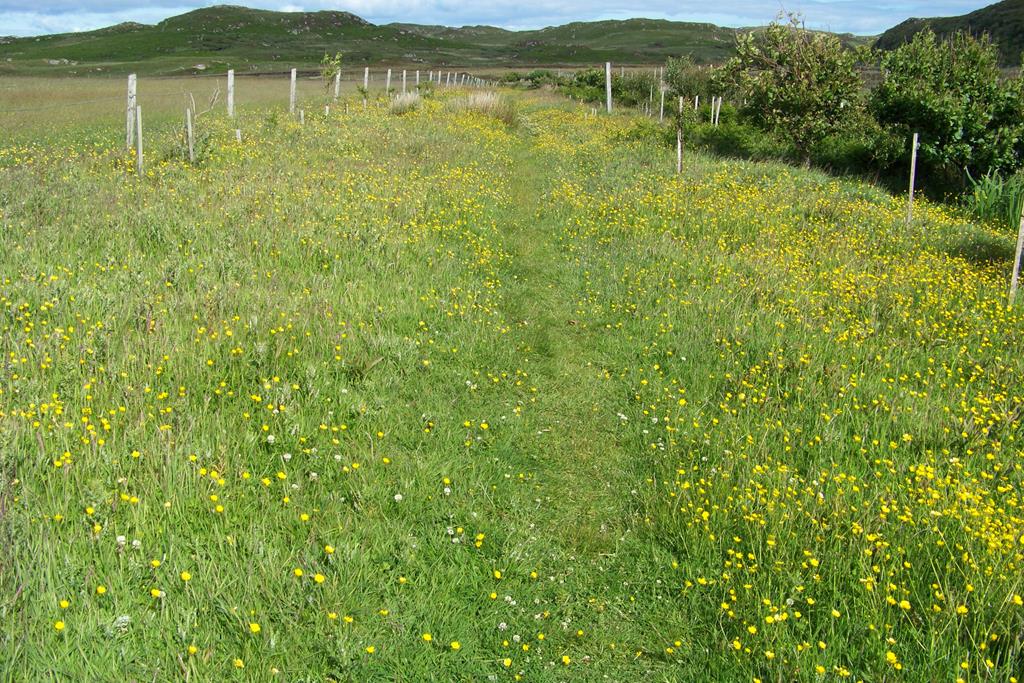
The avenue of wild flowers at the start of the walk
From the metal farm gate at the trail Information Board walk 150 metres east along a fenced in avenue of small trees, there are fields on either side. The path at this point is a
Jane and Meggy Tireragan
mixture of grass and hardcore and in summer is awash with wild flowers. Go through the gate at the east end of the avenue and you turn south east on to a muddy path across open flat peat bog for a few hundred metres to a wooden bridge and the deer fence gate. On crossing the bog keep a look out for golden eagle, buzzard, kestrel, hen harrier, merlin, red deer on the hills to the east, meadow pipit, snipe, and skylark. In summer there are many wild flowers on the bog, click for Wildflower Gallery
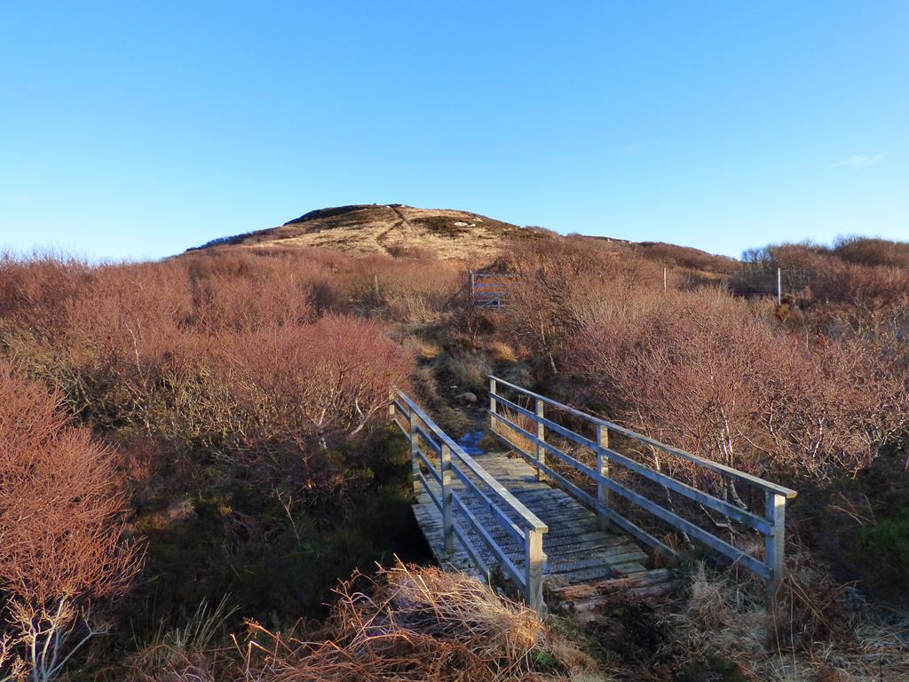
Bridge and deer fence and Tor Fada
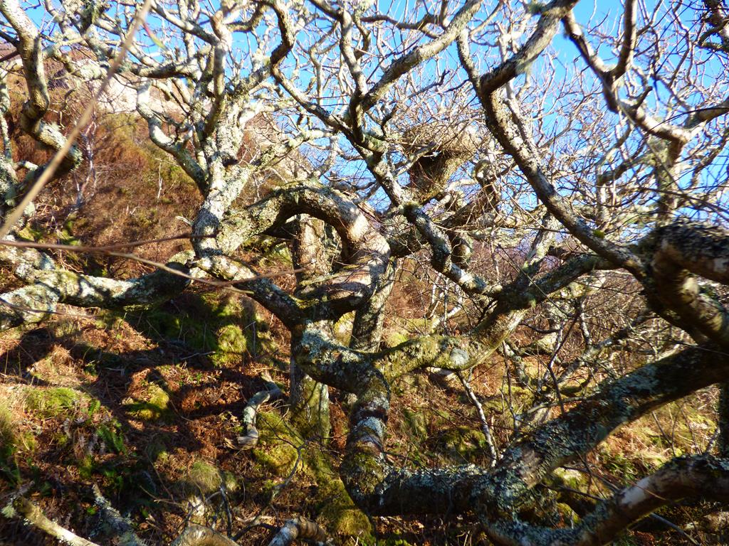
Go through the deer fence at the gate (re secure the chain) and in front of you is a granite stone way mark with 2 choices of travel, an arrow pointing south,( for the circuit around the base of Torr Fada either joining up at the other side of the hill with the trail over the hill, or just to follow the trail and take first trail off to the right (granite way mark) to discover the magic of the native woodland, Seals Bay, views of Eilean Chalmain and the Torran Rocks. In the middle of the woodland there is the largest oak tree on the estate spreading out over a small glen, possibly the oldest oak on Mull. You can return to the main path and deer fence or head south east through the woods and eventually pick up the path to the ruins and beach although beware the path fades out in places. This is a really difficult route clambering over rocks just after the oak tree, for the adventurous types only!, it is advisable to retrace your steps from the Oak Tree back the way to pick up the main path.
view from Tor Fada north east to Ardmeanach and Ben More
The other arrow at the deer fence points south east over Torr Fada hill to a height of 183 metres. This is the direct route to the ruins and beach. The views at the top from the stone
Tireragan estate to Knockvologan fields and Isle of Iona
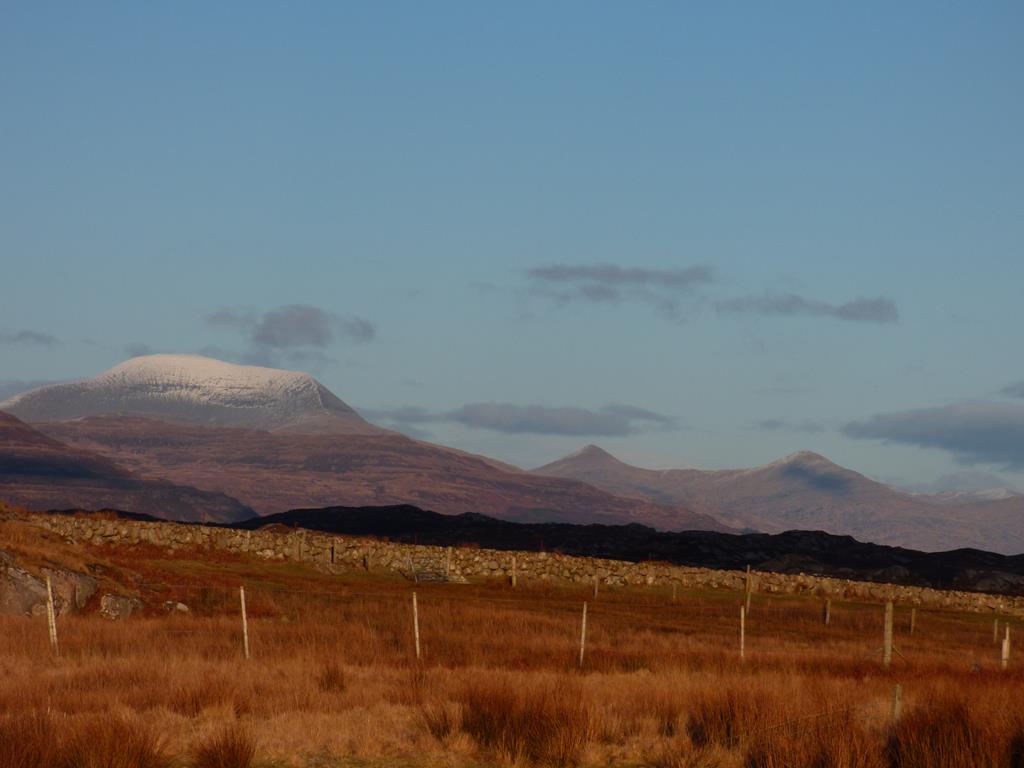
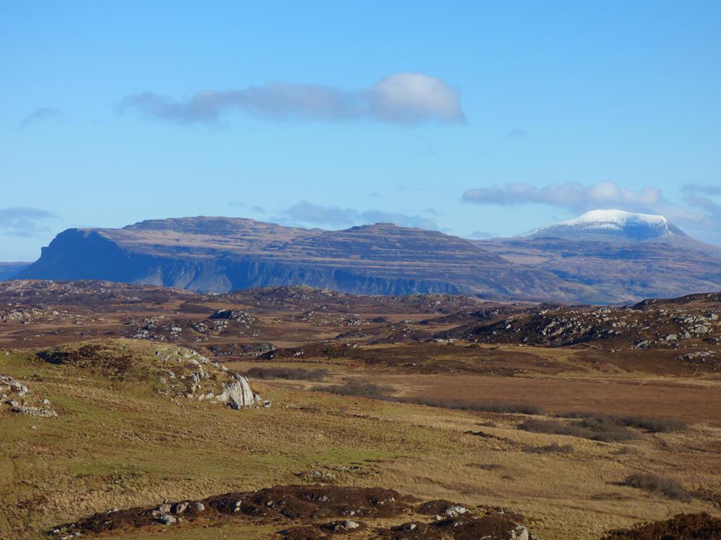
compass are an amazing 360 degree view of islands, sea, cliffs, mountains, lochs, beaches, ruins, farmland and moors, The BIG COUNTRY" I would venture! To the south west on a clear day with binoculars you can see Stevenson's historic Dubh Artach Lighthouse on lonely St John's Rock, read more click here To the north, Isle of Staffa, Treshnish Isles, North Mull and on a clear day Rum and Skye, to the east, Burg, Ardmeanach and Ben More, to the south Chalmain island the Torran Rocks, Colonsay, Islay and Jura, to the west Coll, Tiree, Iona and its historic Abbey, Knockvologan, and Fidden. Also it is worth noting the difference in vegetation of the grazed land to the west and north to the land around you in the conservation estate, non grazed regenerating wild land. Continuing along the Torr Fada ridge eventually descending through a small copse of birch and hazel wood you meet the path from your
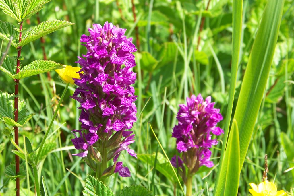
Early Orchid Traigh Ghael
right that goes round Torr Fada at a T junction. (return this way if you have time).However for the ruins and beach walk left at the junction in an easterly to south easterly direction over a soggy moorland path. Below you to the north east you can see glimpses of a ruined settlement on a west facing grassy slope on the other side of the Tireragan deer fence boundary on Fidden land. This is the furthest north settlement of the Tireragan township and is called Cille Mhuire, (Mary's cemetery or cell ) consisting of 8 ruins and one large ruin believed to have been a school. There is also evidence of a chapel and cemetery in this settlement.
To visit this area best to do so from the main Tireragan settlement east from here. (see later)
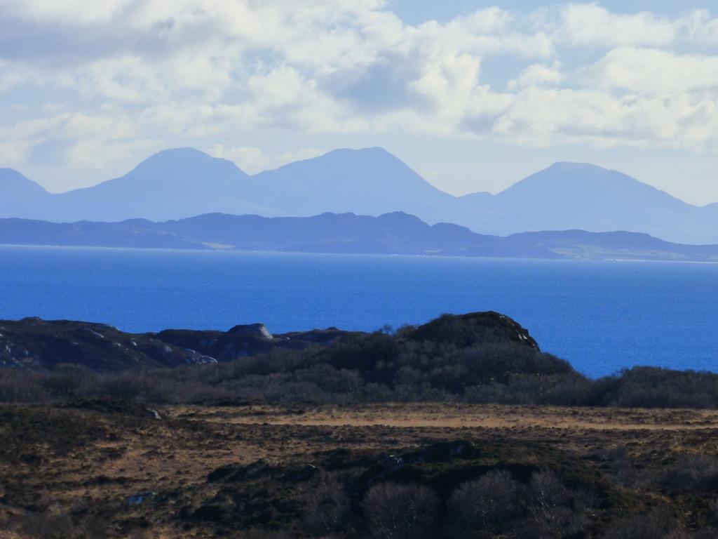
Stevenson's Dubh Artach lighthouse 15 miles from Tor Fada
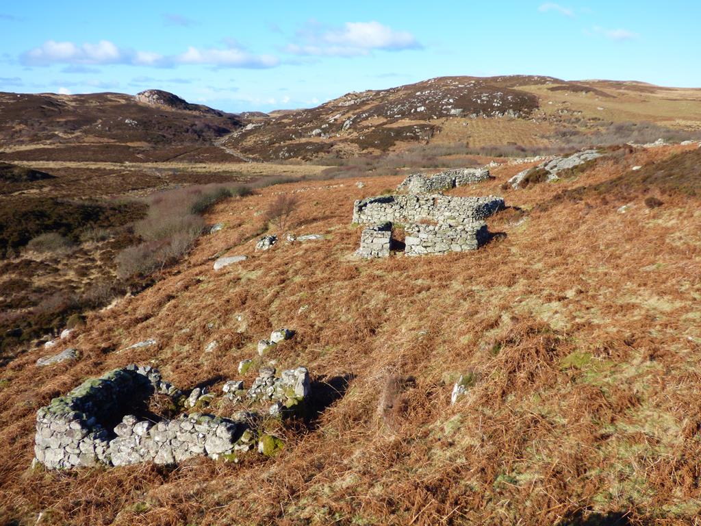
Breac Achadh township from the south
You now descend into a glen running west to east and if the bracken is not too high you will see in the distance the 8 ruined cottages of Breac Achadh (The Speckled Field) on a west facing slope which you will pass on your way to Traigh Ghael Beach. Please note that everywhere you see bracken was once crops and pasture, so there was a lot of fertile ground on which to grow food and you can see the turned over earth forming uniform small hills and valleys called lazy beds, best seen in winter when there is little undergrowth to hide them. At the bottom of the slope there is a smaller path cutting off to the right (west) towards the aforementioned oak tree, an alternative route back if time allows. For the ruins and beach carry on left across a wooden bridge and then shortly after turn left off the main path (if you wish to see Cro na Ba Glas (pen of the grey cow) the main settlement), over a wooden bridge heading up a gentle hill in an easterly direction.
Cro na Ba Glas main settlement Tireregan
Bay of the seals from near the Oak Tree
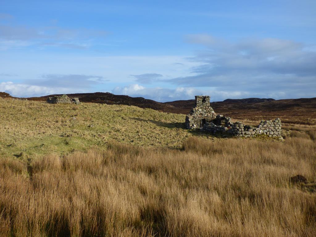
At the top there is a grassy slope stretching east and ten various ruins. There is a stone in the middle of the village, known as the "Pulpit stone" possibly used as a speakers platform. One house is of a more modern and of grander construction, it has square corners and a chimney and gable are still standing. There is the remains of an animal pen at the east side of the settlement This area has an absolutely magical, peaceful feel to it. To the north of the village there is a gate in the boundary fence and if you walk up Glac Roineach hill and over the top in a north westerly direction you will arrive at Cille Mhuire, mentioned earlier. Please note the visits to the off the main track settlements will add to the length of time of your walk.
Paps of Jura from Tireregan on the way to Traigh Ghael beach
For the beach retrace your steps back down to the main path and take left past Breac Achadh ruins in a southerly direction down the boggy path of a shallow glen. In the distance
The spreading Oak Tree of Tireragan
you will see The Paps of Jura and Colonsay, the path clings to the west side of the glen and eventually you descend down sharply through a willow and hazel wood on to the most remote and picturesque, powder white sandy beach on Mull. Traigh Ghael is simply stunning and Jane and John and the dogs have spent many a day with a picnic on the beach and dipping there toes in the water. John also used to fish from his creel boat in this bay catching lobsters, it was also his favorite spot for anchoring for lunch! For your return journey by the shortest route retrace your steps back along the main path and over Tor Fada. If you want to vary your route back , take the path around instead of over
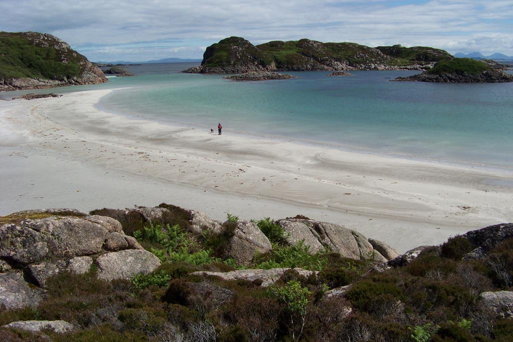
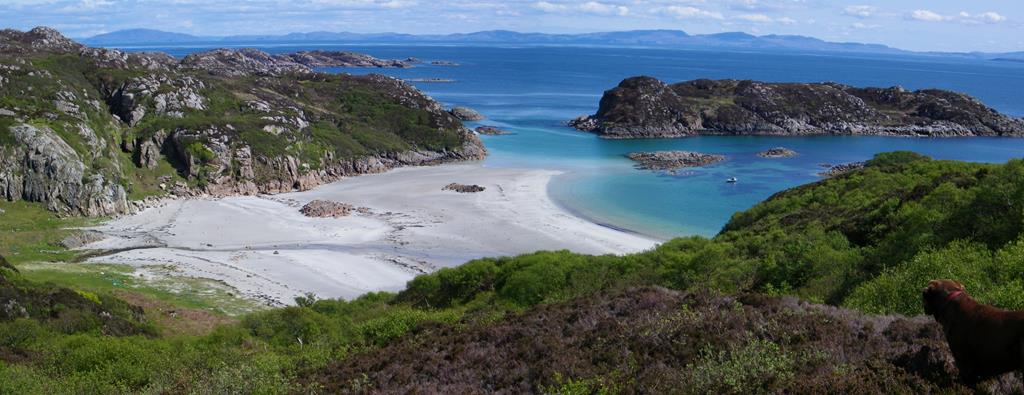
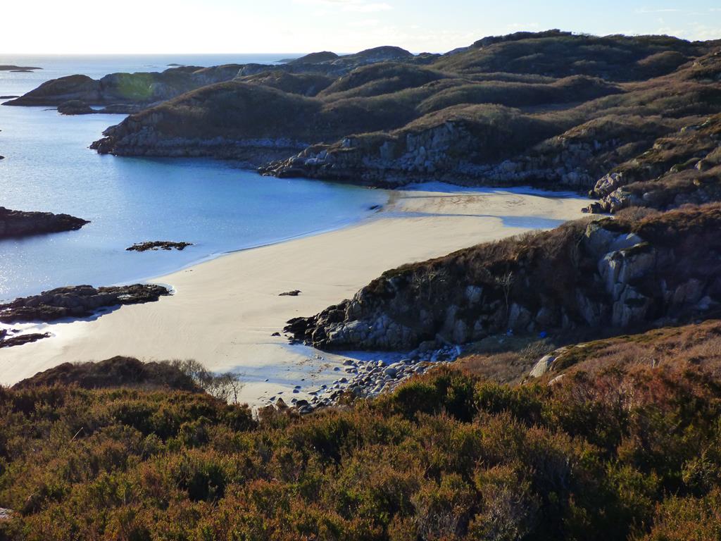
Traigh Ghael the best beach on Mull
Tor Fada ending up at the deer fence gate. A wee tip for a good photograph of the beach, as you climb from the

Honeysuckle at Tireregan Township
beach going through the wood, as the wood finishes, head west a short distance up the hill through the heather and take a similar shot to the one at the top of the page. For detailed information about Tireragan Estate go to their website click here for Tireragan Trust